The lidar station "Paratunka" is located in the village of Paratunka, Yelizovo District, Kamchatka Territory. The coordinates of the station are 52°58'23"N 158°14'50"E. There is a hardware's description.
The database of lidar observations contains information on single-frequency and multi-frequency sounding for the period from 2007-2018. Source data files are presented in binary formats. The measurement frequency is 10 Hz. Each archive contains subdirectories of binary files that are generated every 10 seconds. Registration of scattering signals is made in the photon counting mode. The main measurements are carried out at a wavelength of 532 nm. The slave measurement channel is used to record the lidar signals from the dye laser with a tunable TDL 90 frequency. The data archive structure for one day consists of the YYYY-MM-DD.prop description file and the directories with hourly accumulation of the sensing binary files.
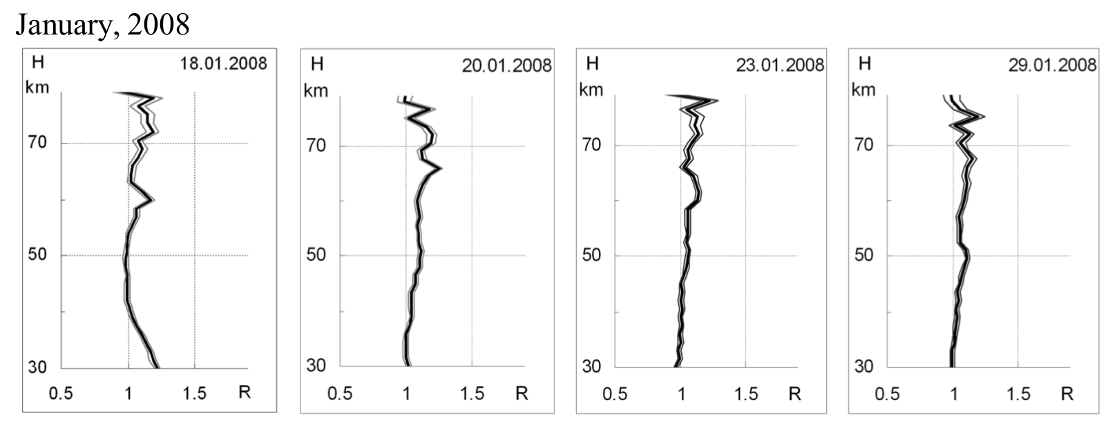
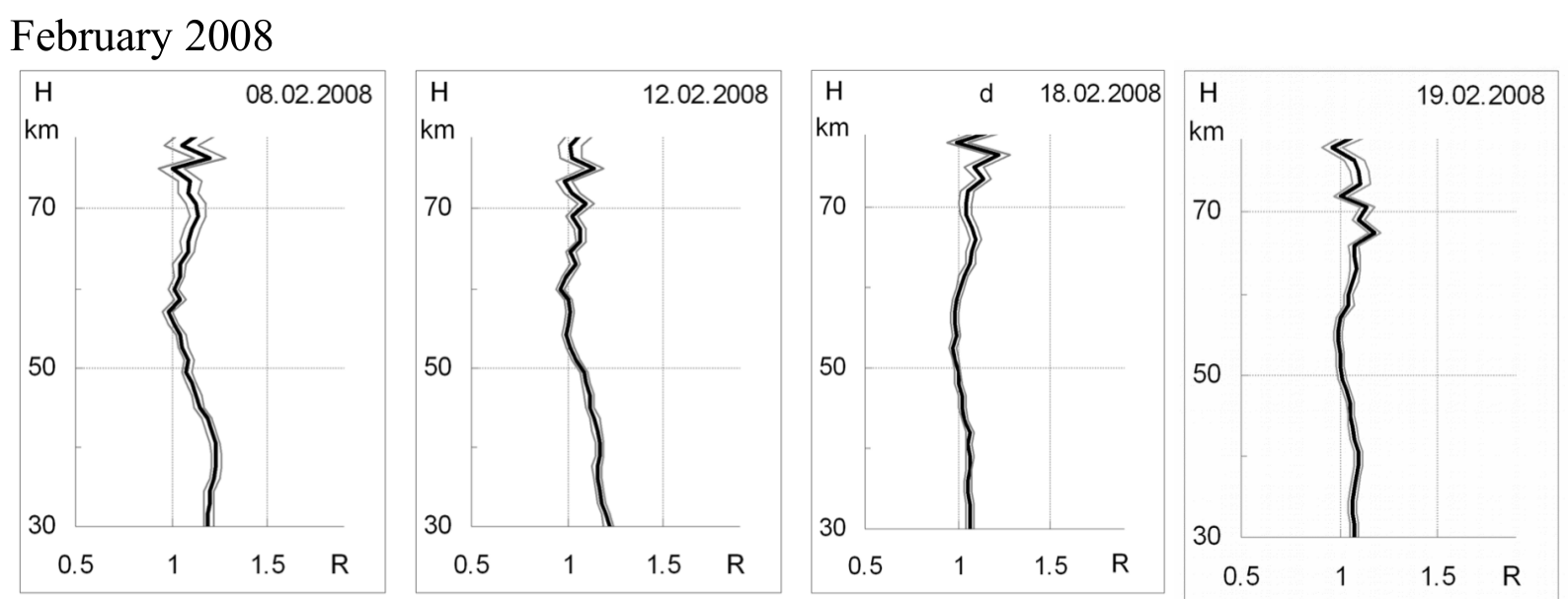
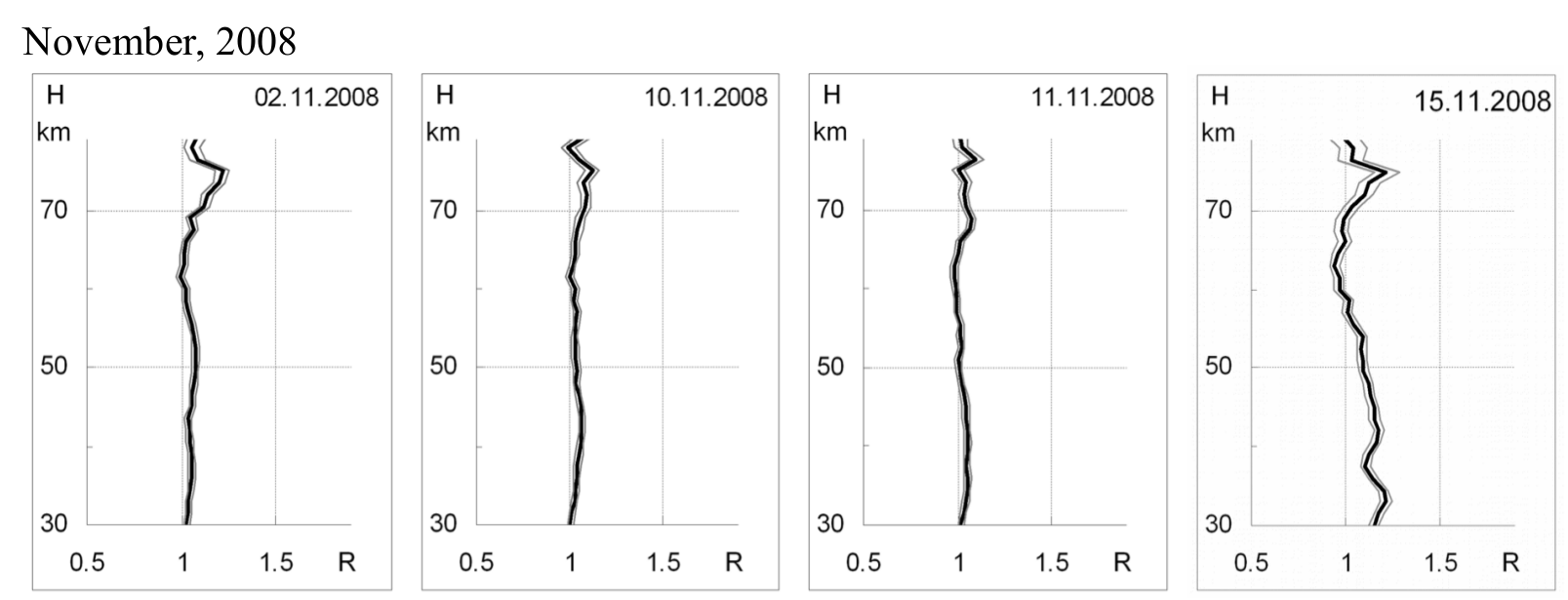
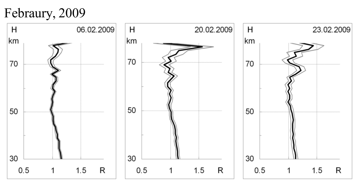
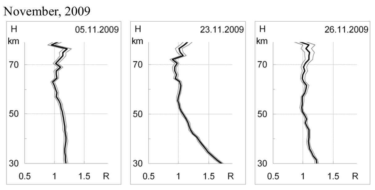
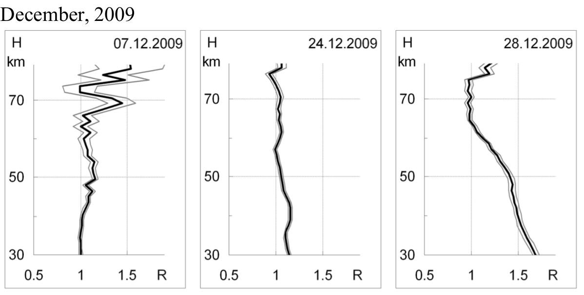
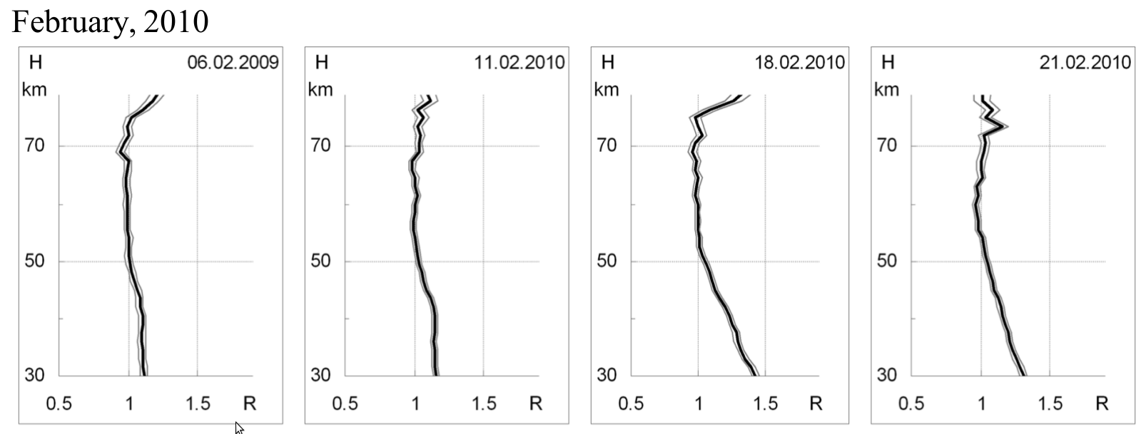
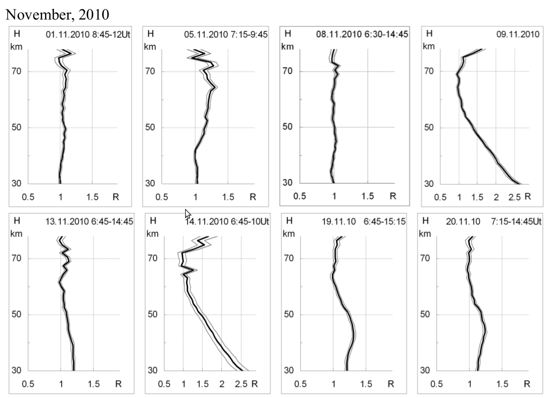
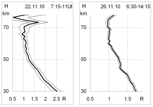
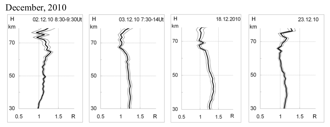
Using the model of elastic single scattering of light, from the data of echo signals, the profile of the scattering ratio R(H) in the stratosphere and mesosphere is restored. NRLMSISE-00 is used as the basic model of the atmosphere. The scattering ratio is defined as the ratio of aerosol and molecular scattering to the magnitude of the latter. In fig. 1 shows examples of processing lidar signals.
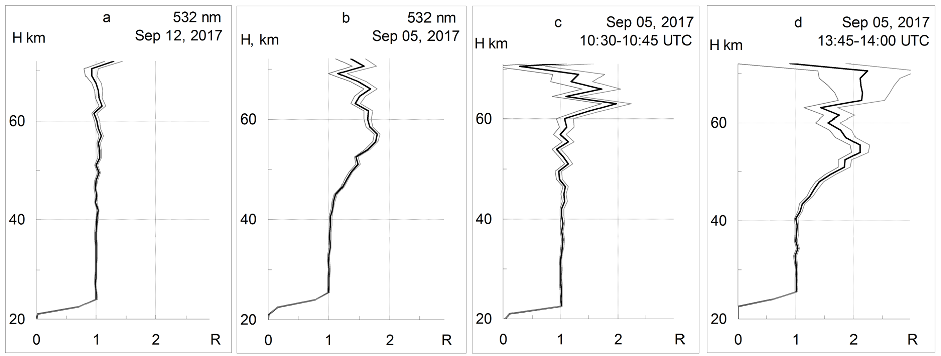
Fig. 1. The altitude distribution of the solution ratio R (H) in the mesosphere.
Of greatest interest are the data obtained in the range of heights from 100 to 500 km. The observations in the thermosphere were made using two-part sounding. The resonance lines of ionized oxygen and nitrogen atoms allow the photon counting mode, taking into account the geometric attenuation factor of the signal, to obtain information on the state of the ionosphere during the precipitation of charged particles. Figure 2 shows the results of dual-frequency sensing.
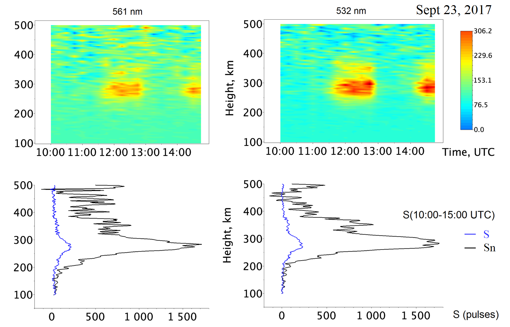

Fig. 2. The time base of the reflected signal is presented in the form of a color scheme. S is the total reflected signal without taking into account the geometric normalization. Sn is the total reflected signal taking into account the geometric normalization.
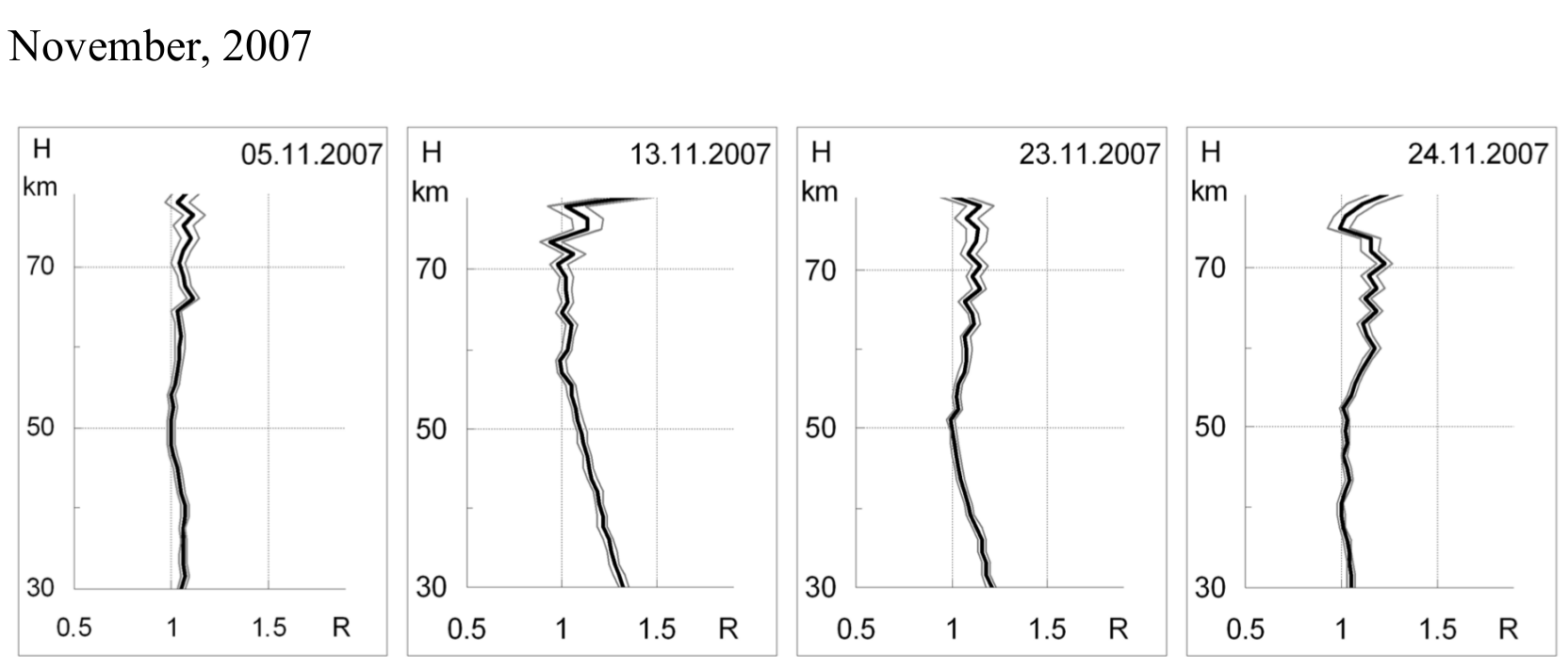
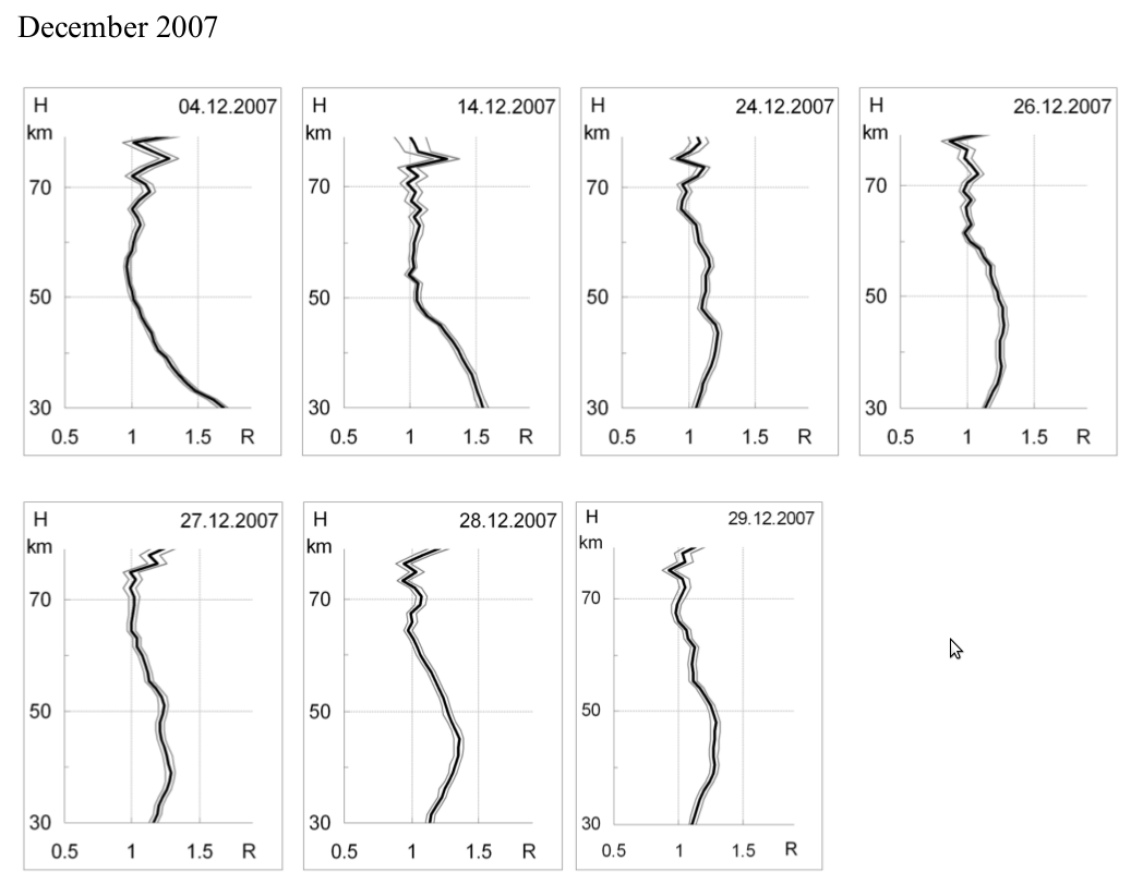
Data for the period from 2007 to 2010 are presented in the form of scattering ratio.
The data for the period from 2010 to 2018 shows in the table files in the format YYYY-MM-DD with an indication of the size, which contain binary probing files.
Database list of file from 2010 to 2018.
To access to the raw data of lidar sensing, please contact the following address ikir@ikir.ru. In the text of the letter, indicate the period for which the data is required and for what research it is planned to use it. When using the data, reference should be made to the Northeastern Eastern Heliogeophysical Center Collective Enterprise Center, registration number 558279.
The lidar database of the thermosphere was prepared with partial financial support from the Russian Science Foundation 14-11-00194.
A database of lidar observations of the stratosphere and mesosphere was prepared with the financial support of SCOSTEP (Scientific Committee on Solar-Terrestrial Physics) and VarSITI (Variability of the Sun and Its Terrestrial Impact).